Langbiang mountain summit trekking tour: Conquering the 2,167m roof of Da Lat
Towering majestically over the Central Highlands plateau, Mount Langbiang stands as the undisputed crown of Lam Dong province. While the majority of commercial tourists ride Soviet-era military jeeps up to paved Radar Hill (1,950 meters), true outdoor adventurers know that the mountain’s authentic spiritual summit—Langbiang Peak at 2,167 meters elevation—can only be reached on foot via our guided Langbiang mountain summit trekking tour. This exhilarating 12-kilometer round-trip expedition leads hikers deep into the protected core of the UNESCO-recognized Langbiang World Biosphere Reserve. Traversing sunlit three-needle pine forests before ascending through dense, moss-draped cloud forests, trekkers are rewarded with sweeping 360-degree panoramas overlooking the Golden and Silver Streams, lush farming valleys, and the distant skyline of Da Lat city. With round-trip transfers, park entry permits, expert local guides, and a hearty trailside picnic lunch included, Sea You Travel provides an unforgettable high-altitude adventure for active explorers.
If you wish to explore other scenic highland outdoor routes, browse our diverse collection of Da Lat tours to pair your summit ascent with technical waterfall canyoning or peaceful lake kayaking.
You can also reference our comprehensive Da Lat travel guide for seasonal trail forecasts, highland temperature fluctuations, and recommended travel gear.
For visitors traveling up from the coast, private express departures can be arranged seamlessly via our Da Lat day tour from Nha Trang.
- Best for: Active hikers, outdoor enthusiasts, adventure photographers, and nature lovers seeking an authentic mountain ascent.
- Highlights: Conquer authentic 2,167m Langbiang Peak, ancient mossy cloud rainforests, endemic birdlife, panoramic views of Golden & Silver Streams, and mountaintop picnic lunch.
- Price: 940.000 VNĐ/guest (Guaranteed daily departure).
- Duration: 1 day (Approx. 7 hours total, 08:00 AM – 15:45 PM).
- Includes: Hotel transfers, professional trekking guide, biosphere reserve permits, trekking poles, summit picnic lunch, hot drinks & insurance.
- Organized by: Sea You Travel – Central Highlands outdoor travel specialist.
Tour pricing, package inclusions and booking information
Sea You Travel offers transparent pricing for individual adventurers, trekking clubs, and small private parties. Our high guide-to-guest ratio ensures personalized safety management, steady pace setting, and engaging botanical storytelling along every section of the trail.
| Service category | Rate per participant | Booking conditions & guidelines |
|---|---|---|
| Public joint-group rate | 940.000 VNĐ | Daily guaranteed shared departure with English-speaking mountain guide |
| Private group charter | Custom quote upon request | Exclusive vehicle, customized start times, and dedicated private trail leader |
| Minimum age (domestic) | From 7 years old and above | Requires good physical stamina and direct accompaniment by parents |
| Minimum age (international) | From 5 years old and above | Suitable for active children accustomed to sustained uphill walking |
| Trek distance & duration | 12 km round-trip (5–6 hours) | Elevations ranging from 1,450m at base to 2,167m at the true summit |
Every ticket covers all mandatory entrance passes, environmental management fees, nutritional trail provisions, and passenger insurance. Below is the itemized service breakdown:
| Included in your tour ticket | Excluded from your tour ticket |
|---|---|
| Round-trip hotel transfers within central Da Lat (or central pickup point) | Value Added Tax (10% VAT upon formal tax invoice request) |
| Professional English/Vietnamese-speaking wilderness mountain guide | Gratuities and tips for guides and expedition drivers |
| Langbiang National Tourism Area entrance tickets and forestry passes | Personal outdoor gear (hiking poles, specialized trekking boots) |
| Trailside picnic lunch featuring fresh baguettes, cheeses, meats, and fruit | Personal retail purchases, specialty beverages, or herbal wines |
| Purified bottled drinking water (500ml per guest) and emergency first-aid | Personal medical or emergency mountain evacuation insurance |
| Standard passenger travel insurance coverage | Accommodations in Da Lat city before or after the tour |
Advance reservations are recommended to secure professional mountain guides during peak weekend periods. To request your summit trek, submit your preferred date, party size, hotel address in Da Lat, and any dietary requirements.
Our team is ready to help you choose the right tour, itinerary, and travel service.

Understanding the mountain: Radar Hill vs. the authentic 2,167m Langbiang Peak
Many travelers visiting Da Lat unknowingly confuse the commercial tourist viewpoint with the real mountain peak. Understanding this distinction is essential when planning an authentic outdoor conquest:
| Comparison criteria | Radar Hill (Commercial Viewpoint) | Langbiang Peak (Authentic Summit) |
|---|---|---|
| Elevation | 1,950 meters above sea level | 2,167 meters above sea level (The true “Roof of Da Lat”) |
| Access method | Paved asphalt road via commercial Russian jeeps | Footpath only via pristine mountain trekking trails |
| Atmosphere | Bustling tourist plazas, souvenir stalls, photo booths | Untouched, peaceful alpine wilderness with dramatic ridgelines |
| Ecosystem | Cleared hillside slopes and ornamental gardens | Virgin subtropical rainforest, ancient mosses, endemic orchids |
| Physical reward | A quick 15-minute vehicle ride | A triumphant 6-hour wilderness ascent conquering 700m elevation gain |
While Radar Hill provides convenient views for mass tourism, it falls far short of the dramatic majesty found atop Langbiang Peak. Our trekking itinerary bypasses the jeep road entirely, taking you deep into the primeval cloud forests that few mainstream tourists ever experience.
Detailed summit itinerary: From pine valleys to high-altitude cloud forest
Covering an active 7-hour timeframe from morning pickup to afternoon return, this expedition balances a vigorous cardiovascular workout with ample pauses for nature photography and botanical discovery.
| Time schedule | Trek stage | Terrain characteristics & trail highlights |
|---|---|---|
| 08:00 – 08:30 | Morning assembly & transit | Pickup across central Da Lat; scenic 12km drive north to Lac Duong district |
| 08:45 – 09:15 | Trailhead briefing | Gear check, hiking pole adjustment, safety briefing, and warm-up stretches |
| 09:15 – 10:30 | Pine forest trail ascent | Moderate climb through airy three-needle pine forests; valley farming views |
| 10:30 – 12:00 | Jungle cloud forest climb | Steep technical ascent through primary mossy rainforest with natural root ladders |
| 12:00 – 13:15 | Summit conquest & picnic | Reaching 2,167m peak marker; 360-degree panoramas; hearty trailside lunch |
| 13:15 – 15:00 | Downhill forest descent | Scenic descent through shaded highland canopies returning to mountain base |
| 15:00 – 15:45 | Transfer back to city | Vehicle transfer returning guests comfortably to their Da Lat city hotels |
Stage 1: Ascending through the fragrant three-needle pine forests
Following a short 25-minute drive from downtown Da Lat through the vegetable fields of Lac Duong, the group arrives at the foot of Mount Langbiang. The opening segment of the trail weaves gently upward through open groves of native three-needle pines (Pinus kesiya). The air here is crisp, cool, and infused with the invigorating scent of wild pine resin. As you gain elevation, the trail reveals captivating backward glances over traditional K’Ho indigenous villages, greenhouse farms, and undulating highland valleys. Your guide introduces the legendary folklore of K’Lang and H’Biang—the star-crossed tribal lovers whose tragic romance gave the mountain its timeless name.
Stage 2: The steep climb through virgin broadleaf cloud rainforest
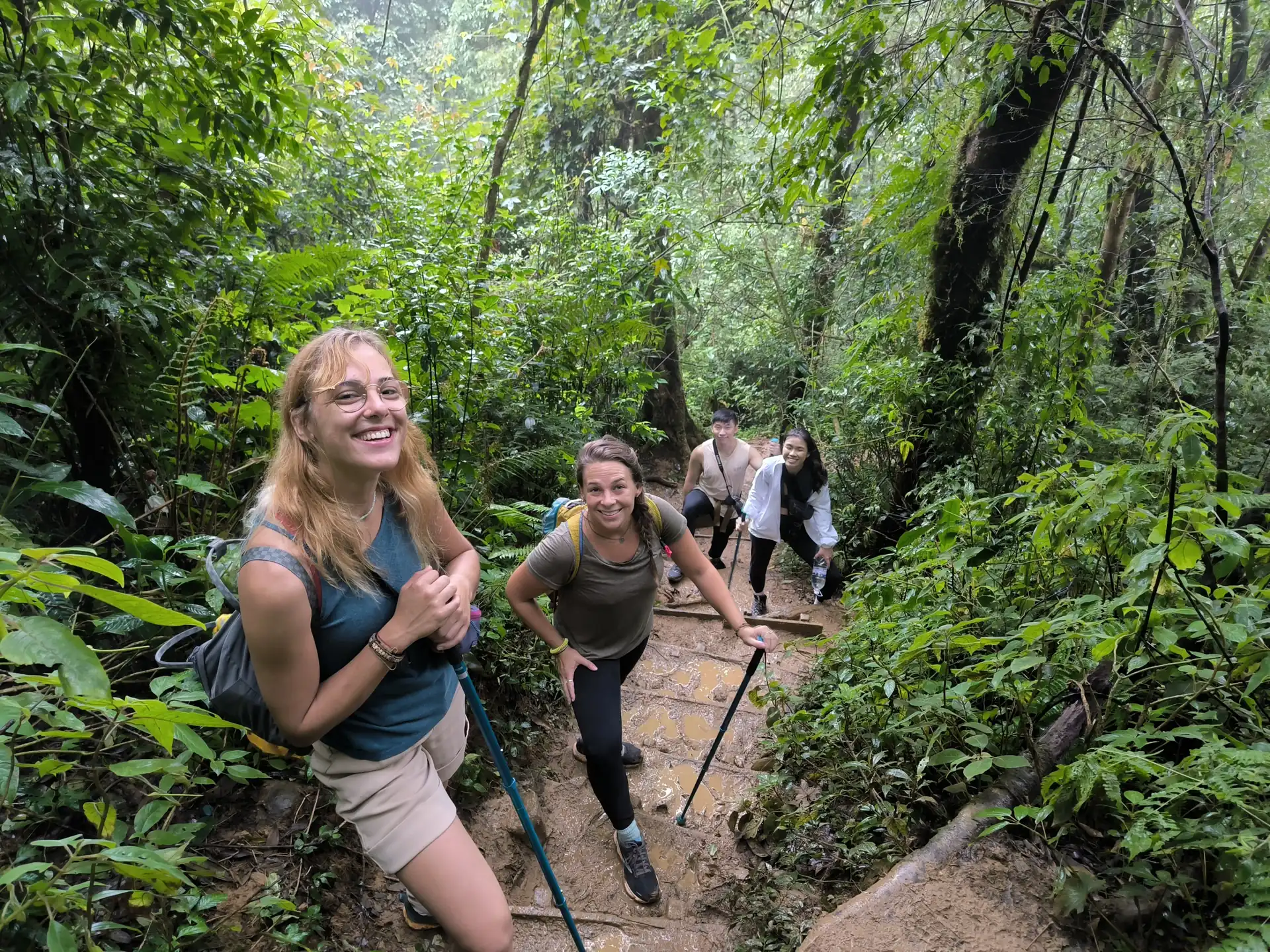
At approximately 1,800 meters elevation, the open pine savannah abruptly gives way to a dense, moisture-rich evergreen broadleaf rainforest. Here, the temperature drops noticeably, and sunlight filters through a thick canopy of ancient oak, chestnut, and rhododendron trees draped in emerald moss, hanging lichens, and delicate wild orchids. The trail turns steeper, with inclines reaching 30 to 40 degrees. Hikers navigate natural stone steps and exposed tree roots that form rugged earth staircases. The peaceful stillness of the deep forest is broken only by the melodic calls of endemic highland birds, including the Langbian Sunbird and Grey-crowned Crocias.
Stage 3: Standing victorious atop Langbiang Peak (2,167m)
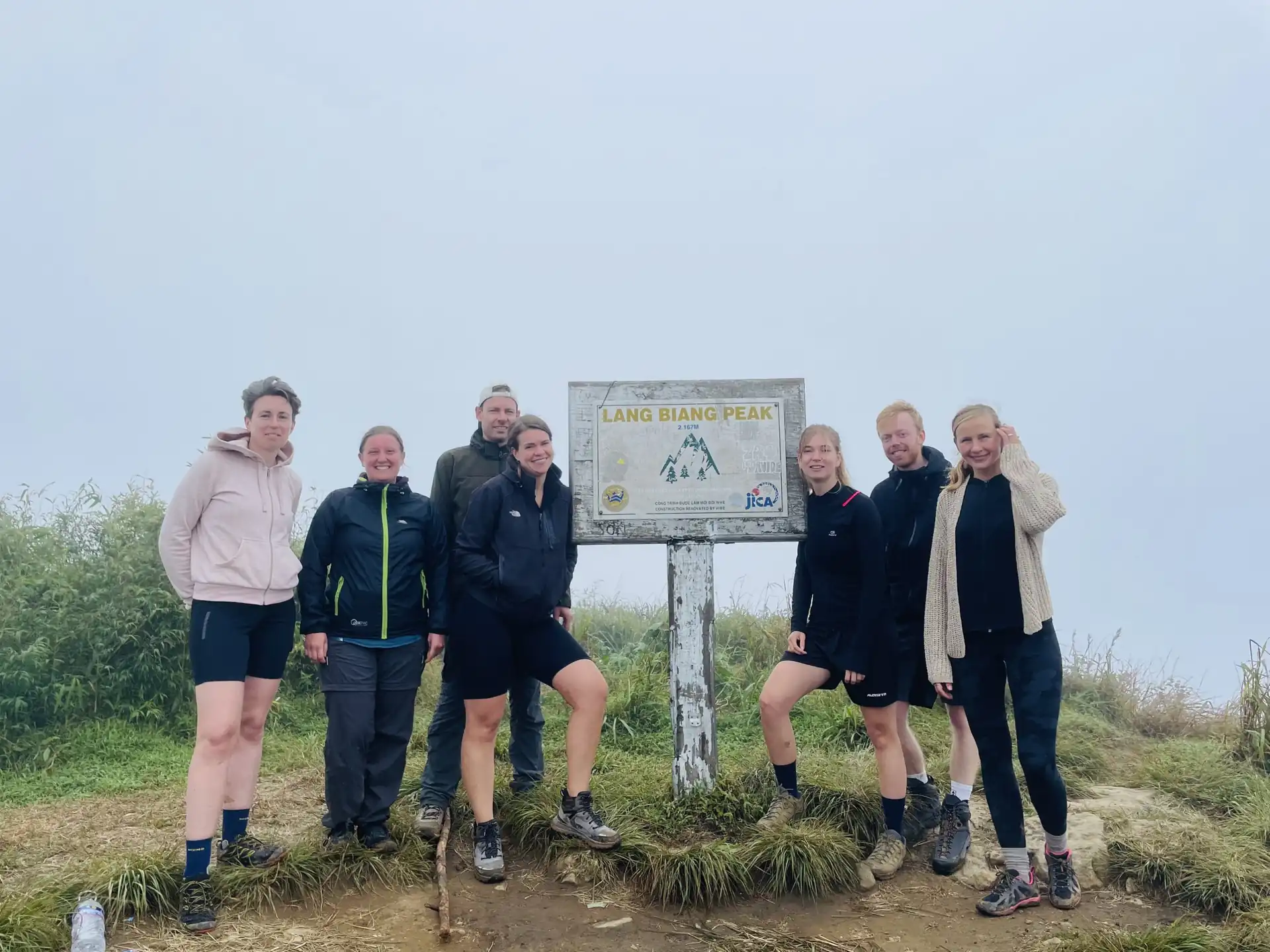
Breaking through the final forest thicket, you emerge onto the windswept grassy ridge of Langbiang Peak. Standing proudly beside the iconic wooden 2,167M elevation marker, the sense of personal triumph is overwhelming. On clear mornings, the panoramic view extends for tens of kilometers in every direction: below lie the serpentine ribbons of the Golden Stream (Suoi Vang) and Silver Stream (Suoi Bac) weaving through Dan Kia Lake, while the sprawling topography of the Da Lat plateau unfolds toward the southern horizon. Floating sea clouds frequently drift past the summit ridge, creating the magical sensation of standing above the clouds.
Stage 4: Trailside picnic lunch and forest descent
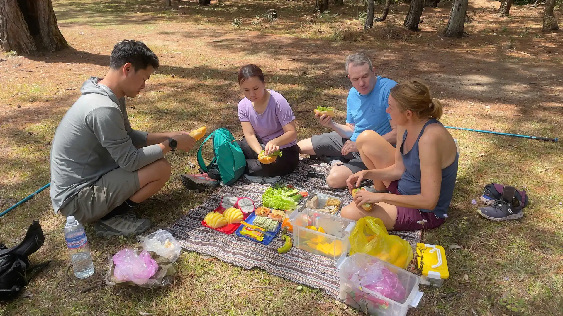
Sheltered from ridge gusts in a scenic mountain glade, the group gathers on insulated mats to enjoy a well-deserved picnic lunch. The menu features fresh Da Lat baguettes, sliced cold meats, creamy cheeses, crisp cucumbers, ripe tomatoes, and sweet seasonal fruits. Recharged with carbohydrates and hot tea, hikers begin the downhill journey. Descending requires steady foot placement and careful knee control, which our guides support with pace regulation. By 15:00 PM, the team reaches the base camp, where our private vehicle awaits to transport you back to your hotel.
Trail difficulty, physical requirements and packing checklist
Conquering a 2,167-meter mountain requires reasonable physical stamina, agility, and appropriate gear. Reviewing the trail parameters below ensures a safe and comfortable ascent:
Is this trek suitable for beginners?
The trek is graded as Moderate. While technical rock-climbing ropes are not required, the route involves a continuous 700-meter elevation gain over rugged, uneven terrain. Anyone with average aerobic endurance who exercises regularly will find the hike challenging but completely achievable. First-time hikers should maintain a steady, unhurried pace and utilize trekking poles to reduce impact on knees and ankles.
Health precautions and medical considerations
Due to sustained steep sections and high altitude, this trek is not recommended for pregnant women or individuals with severe heart conditions, chronic asthma, or severe knee and back ailments. If you experience mild altitude sensitivity, stay well-hydrated and breathe deeply throughout the forest climb.
Essential packing checklist for the summit climb
- Sturdy footwear: Trail-running shoes or hiking boots with aggressive tread patterns are strictly mandatory. Smooth-soled fashion sneakers, flip-flops, or leather casual shoes are unsafe on wet roots and mud.
- Hiking apparel: Breathable synthetic t-shirts and flexible trekking pants. Long pants are recommended to protect against brush scratches and stinging nettles in the cloud forest.
- Warm outer layer: Summit temperatures can be 5°C to 8°C cooler than the city center, accompanied by brisk winds. Bring a lightweight windbreaker or fleece jacket.
- Rain gear: Highland weather can change rapidly; pack a compact rain poncho or waterproof jacket.
- Sun protection: High-SPF sunscreen, lip balm, sunglasses, and a wide-brimmed hat for exposed ridge sections.
- Daypack & hydration: A lightweight 15-to-25-liter backpack to carry your personal water bottle, camera, and spare dry socks.
Frequently asked questions about Langbiang summit trekking
Can I take the tourist jeep down if I get tired at the summit?
No. Commercial jeeps only operate between the base ticket gate and Radar Hill (1,950m), which is separated from Langbiang Peak (2,167m) by a deep mountain saddle and dense primary rainforest. There is no vehicular road connected to the authentic summit; therefore, all trekkers must hike back down along the forest trail accompanied by our guide.
What is the best season to hike Mount Langbiang?
The dry season from November to April offers the clearest blue skies, dry trail surfaces, and spectacular long-distance visibility from the summit. During the rainy season (May to October), morning ascents remain very rewarding, but trails can become slippery and afternoon rain showers are common. We provide trekking poles and choose optimal morning windows to maximize trail safety year-round.
Are restrooms available along the hiking trail?
Restroom facilities are available at the base entrance before commencing the hike. Once you enter the pine forest and biosphere reserve, there are no built commercial facilities. Trekkers adhere to eco-friendly wilderness practices, and our guides carry basic hygiene supplies.
How do I reserve my trek with Sea You Travel?
You can reserve your date directly through our Sea You Travel contact page or message our 24/7 adventure desk on WhatsApp (+84 794 100 979). We will confirm your pickup address, party count, and provide a comprehensive pre-departure checklist.
Included
- Hotel transfers: Round-trip transfers between central Da Lat and Langbiang mountain base.
- Professional mountain guide: Certified English-speaking mountain trekking guide with extensive highland flora/fauna knowledge.
- Conservation admission: Langbiang Biosphere Reserve and National Forest entry conservation tickets.
- Hiking equipment: Lightweight aluminum trekking poles and emergency first-aid kit support.
- Summit picnic lunch: Wholesome mountaintop picnic lunch at 2,167m (fresh baguettes, deli meats, cheese, boiled eggs, salad, and fruits).
- Trail refreshments: Energy chocolate bars, trail biscuits, hot ginger tea, and 1.5L bottled drinking water per guest.
- Summit certificate: Commemorative certificate of summit conquest from Sea You Travel.
- Insurance: Mountain trekking travel accident insurance.
Exclusions
- Jeep rides: Langbiang radar hill jeep ride (this is a pure hiking route to the authentic 2,167m peak; radar jeep is separate).
- Footwear: Personal hiking boots or high-traction trail running shoes.
- Personal daypack: Small backpack, rain poncho, and sun protection gear.
- Gratuities: Tips for mountain guide and driver.
- Government tax: 10% VAT upon formal invoice request.
Children's Policy
- Minimum age guideline: Suitable for active children aged 10 years and older with regular stamina for continuous mountain hiking.
- Children from 10 to 13 years old: Charged at 80% of adult rate (Must hike with an accompanying parent/guardian; includes trekking poles, summit picnic, and guide support).
- Children 14 years and above: Charged at 100% of adult rate.
- Children under 10 years: Not recommended for the strenuous 2,167m summit hike (the gentle Langbiang radar peak jeep tour is advised instead).
Cancellation Policy
- 24+ hours before departure: 100% full refund (Free cancellation).
- 12 to 24 hours before departure: 50% cancellation fee applied.
- Under 12 hours before departure or no-show: 100% cancellation fee (Non-refundable).
- Force majeure & severe weather: In the event of dangerous flash floods, severe gales, or official site closures by local forestry/tourism authorities, guests receive a 100% full refund or free date rescheduling.
Terms & Conditions
- Complimentary pickup & drop-off: Included for all accommodations within central Da Lat city limits. Outer-zone resorts subject to transfer surcharge.
- Footwear requirement: Sturdy hiking shoes or trail running sneakers with high-traction rubber soles are mandatory. Smooth-soled shoes or sandals are prohibited on trails.
- Clothing recommendation: Breathable synthetic sportswear, warm outer layer for mornings/summits, and a spare change of dry clothes for water activities.
- Sun & weather protection: Wide-brimmed sun hat, sunglasses with strap, waterproof phone pouch, and lightweight rain jacket/poncho recommended.
- Environmental conservation: Leave No Trace policy strictly enforced. All litter must be packed out; smoking and open fires are forbidden in pine reserves.
- Health self-declaration: Guests must inform guides of pre-existing cardiovascular, respiratory, or joint conditions prior to departure.
- Holiday surcharge: 15% – 20% surcharge on official Vietnamese public holidays.